Length: 1.3 miles round trip
Elevation Gain: 439 ft
Difficulty: Easy
Trailhead: Sugarloaf Mountain Trailhead
Family Friendly? Yes
Sugarloaf Mountain is a fairly short and easy hike just outside of Boulder. It makes for an excellent day hike that will leave you time to do other things, such as check out Boulder shops or dining.
You can actually see Sugarloaf Mountain from the surrounding plains as it is a clearly visible front range peak. The top of the peak sits in Roosevelt National Forest.
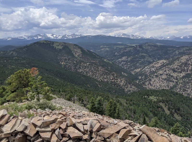
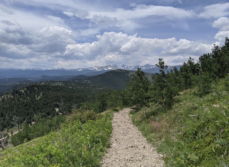
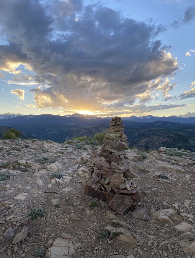
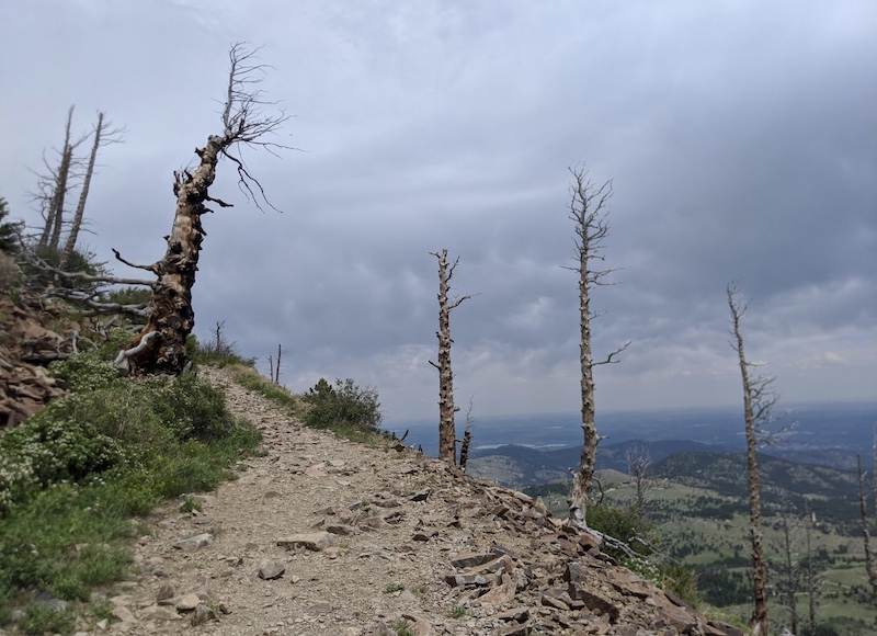
People love this hike because it’s so close to Boulder, easy to hike, and best of all, has incredible views at the top. From the bare, rocky top you can see Indian peaks to the west and Longs peak and Rocky Mountain National Park to the north. Views of the lower plains and Boulder to the east are also excellent. One of the reasons for Sugarloaf Mountain’s popularity is its 360 degree views at the summit.
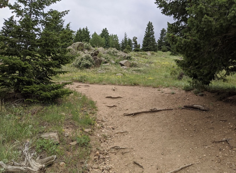
The trail itself is well maintained and doesn’t require any technical ability. Keep in mind, though, that it is a gravel trail and can be somewhat uneven in some places so strollers are not going to work.
From Boulder it only take about 30 min to drive and hike to the top. It’s a fantastic hike year-round and has typical front range plants.
It takes an average of 30-50 minutes to hike from your car. It’s a popular area for birding, hiking and horseback riding.
You can actually create a bit of a loop out of this trail, or keep it as an out and back. The fork in the trail for the loop is about halfway up the trail, and it deposits you back at the exact same trailhead you started from. The Alltrails app should have a map of both trails, but it’s pretty obvious even without using a map.
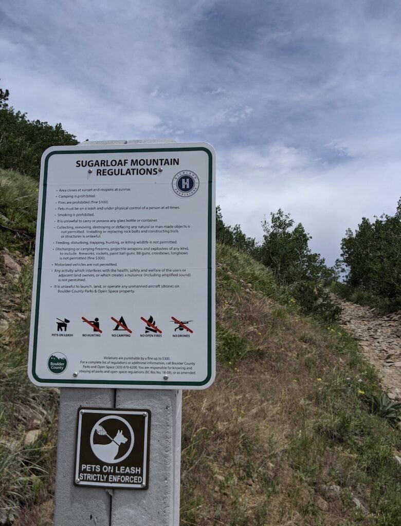
Dogs are allowed, but must be on a leash at all times. The parks in this area do have rangers checking every so often, and the fines are hefty if they catch you with your dog off-leash.
Sugarloaf Mountain is an ideal hiking spot for families looking to spend some quality time together in nature. With its short and easy trail, even young children can easily make the hike to the top. The views from the summit are breathtaking, making it a rewarding experience for all ages. The area is also popular for birding and horseback riding, providing an opportunity for kids to learn about different animals and plants. Just remember to keep your furry friends on a leash and be prepared with snacks and water for the little ones.
Nearby is a popular hiking and mountain bike trail called the Switzerland Trail. You can avoid most of the mountain biking traffic, though, by staying on the sugarloaf mountain trail.
Sugarloaf Mountain is a great destination for easy access to wildlife as well. Deer, moose and elk are among the many front-range animals that you might run into on the trail.
The trail might be a little more challenging to hike in the winter if there is snow and ice. However, because so many people hike this trail, the snow is often packed down throughout the winter (unless it’s right after a heavy snow). Bringing microspikes or some sort of traction for your feet is a good idea in the winter if there is ice, which usually accumulates as people pack down the snow.
Directions to Sugarloaf Mountain Trailhead
To get to Sugarloaf Mountain from downtown Boulder, head west on CO 119 towards Nederland. After about 4.5 miles, turn right onto Sugarloaf Road. The road will get steep, then flatten out, then start to climb again. At this point, you should be able to see Sugarloaf Mountain from the road.
After about 4 miles, turn right onto Sugarloaf Mountain Road (located at the top of the road). If you start going downhill, you’ve gone too far.
Take the dirt Sugarloaf Mountain Road for 1 mile to reach the large parking area for the Switzerland Trail. Although most passenger cars can make it up this road, it is a bit of a bumpy ride.
Also, the trailhead is actually opposite the Sugarloaf Mountain map and sign.
From the parking lot, look to the east and you’ll see a rocky trail that leads up to Sugarloaf Mountain. Follow this trail, which is just over 1/2 mile one-way and gains about 400 feet. It should take you around 15-20 minutes to reach the summit. Keep an eye out for a gate a few yards up the trail. Once you reach the summit, you’ll be rewarded with incredible views of the surrounding area.
Hiking Checklist for Sugarloaf Mountain
- Appropriate footwear: Invest in a good pair of hiking boots or shoes that provide support, stability, and traction. Make sure to break them in before your hike.
- Weather-appropriate clothing: Check the weather forecast and dress accordingly. Bring extra layers, rain gear, and sunscreen.
- Navigation tools: Bring a map, compass, and/or GPS device to help you navigate the trail.
- Snacks and water: Bring enough food and water for the duration of your hike. Pack snacks that are easy to carry and provide energy.
- First aid kit: Pack a basic first aid kit with essentials like band-aids, gauze, antiseptic wipes, and pain relievers.
- Emergency supplies: Bring a whistle, flashlight, and extra batteries in case of an emergency.
- Sun protection: Bring a hat, sunglasses, and sunscreen to protect your skin and eyes from the sun.
- Insect repellent: Depending on the season and location, bring insect repellent to ward off bugs.
- Personal hygiene items: Bring toilet paper, hand sanitizer, and a small towel or wipes for personal hygiene.
- Backpack: Carry all of your gear in a sturdy and comfortable backpack that fits properly. Adjust the straps to distribute the weight evenly.
Remember to always let someone know where you are going and when you plan to return, and follow Leave No Trace principles by packing out all trash and minimizing your impact on the environment.